Defining Point Values of a Surface
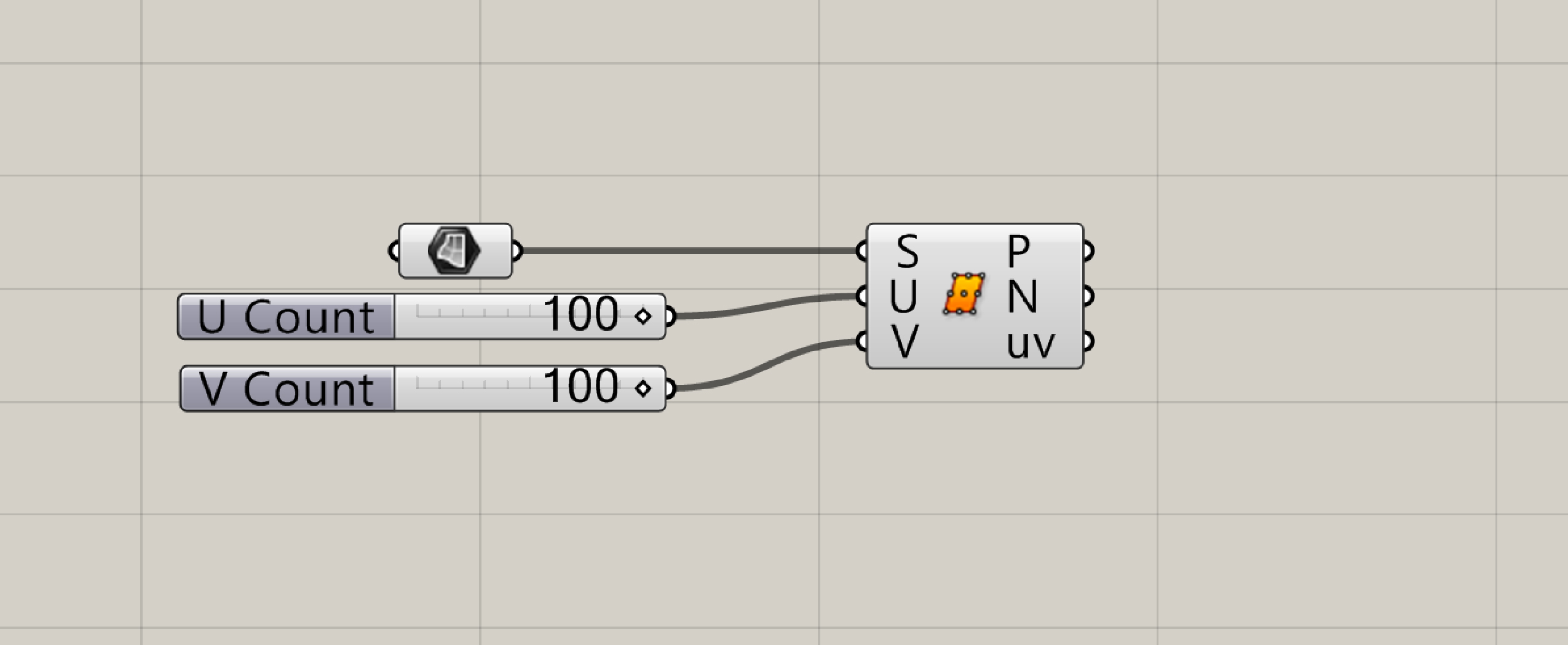
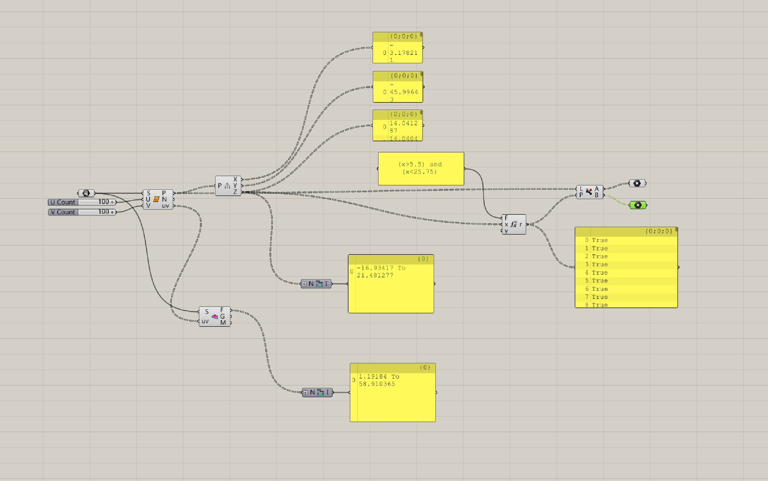
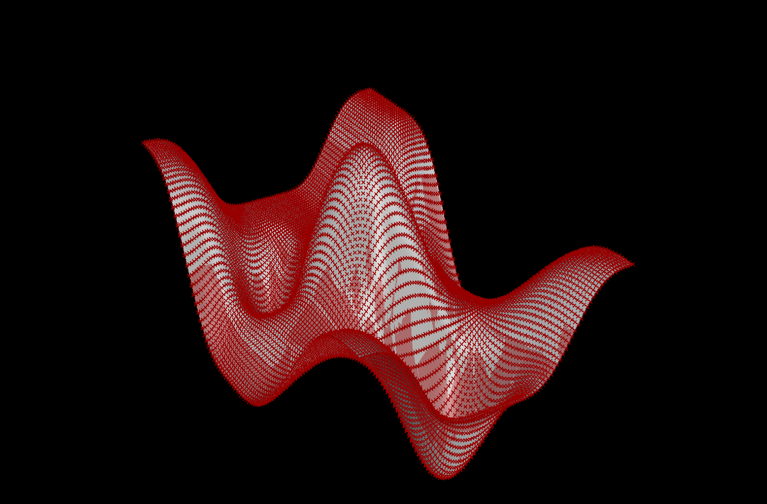 assign a surface created in Rhino to redifine its mesh subdivision
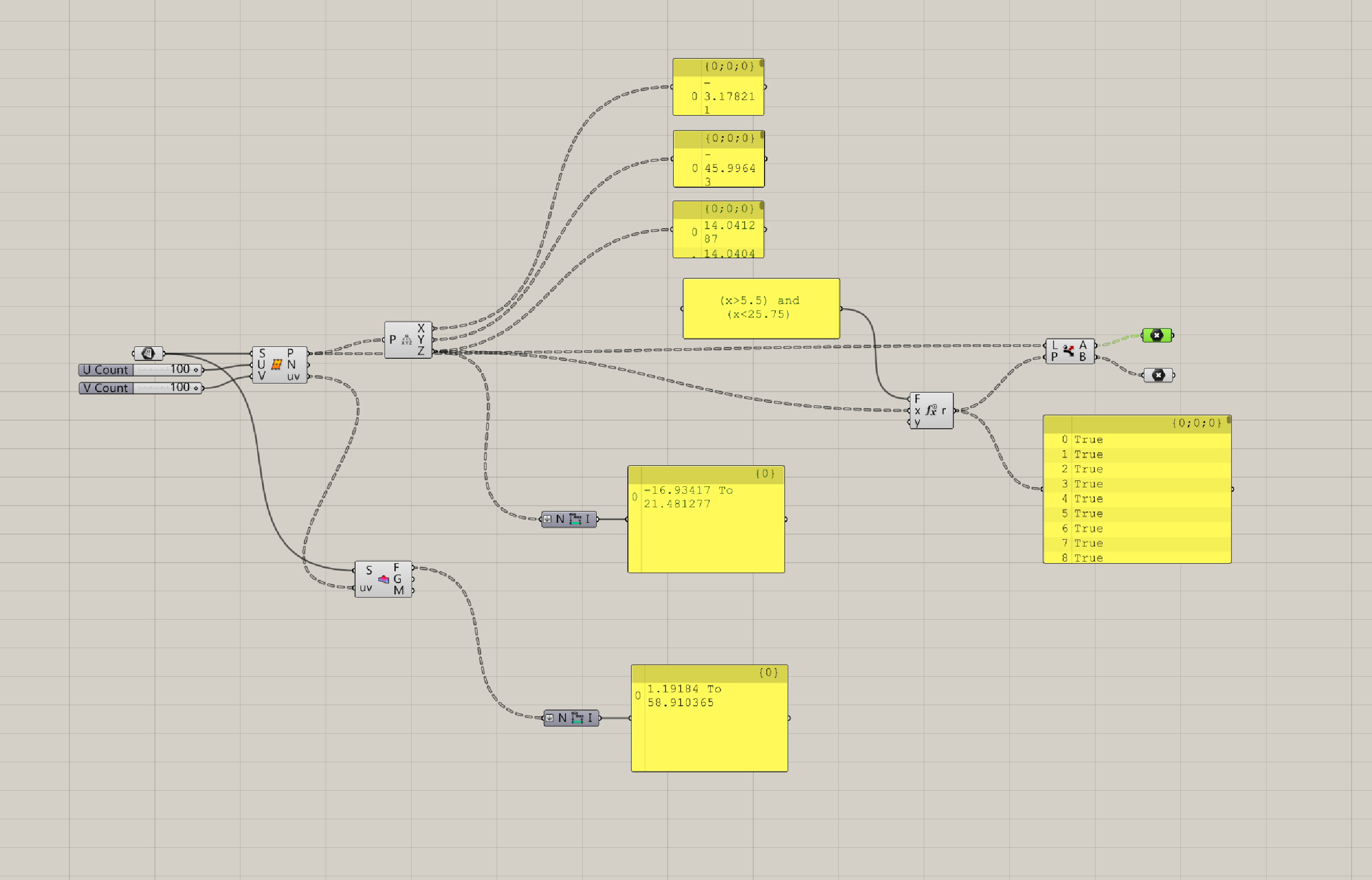
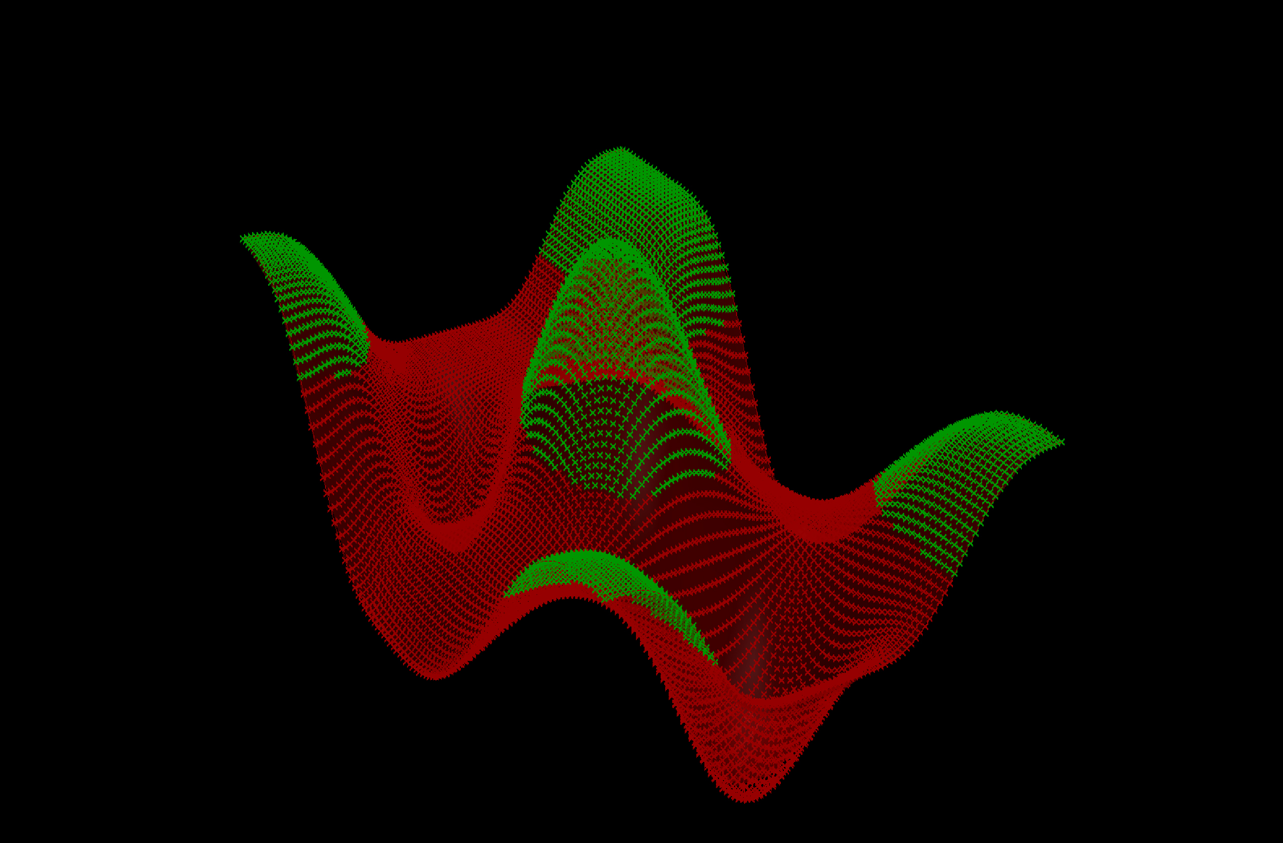 create a list that separates the points' range between those in the low-lying topography and those that are occuring on higher grounds.
(high points)
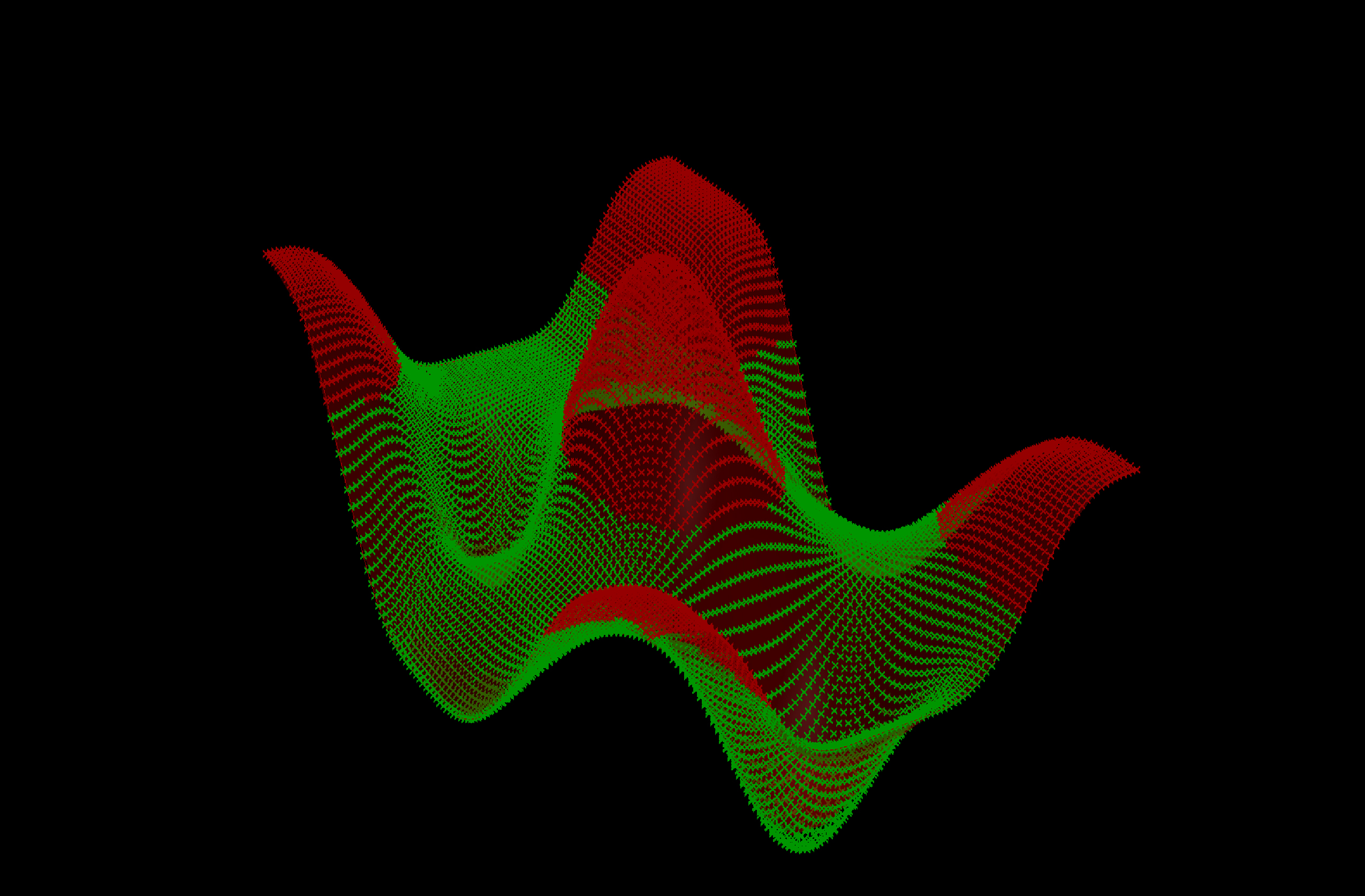 (low points)
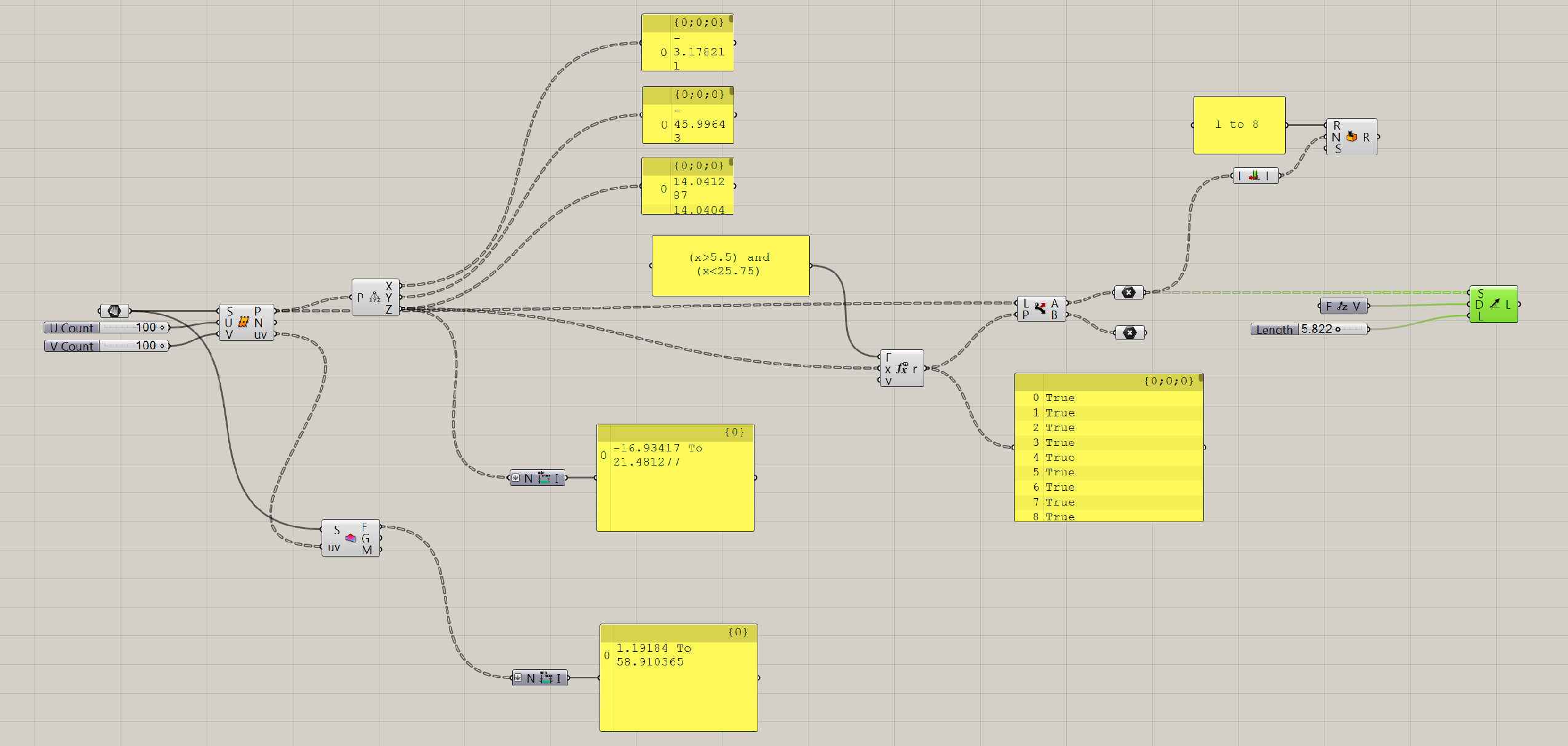
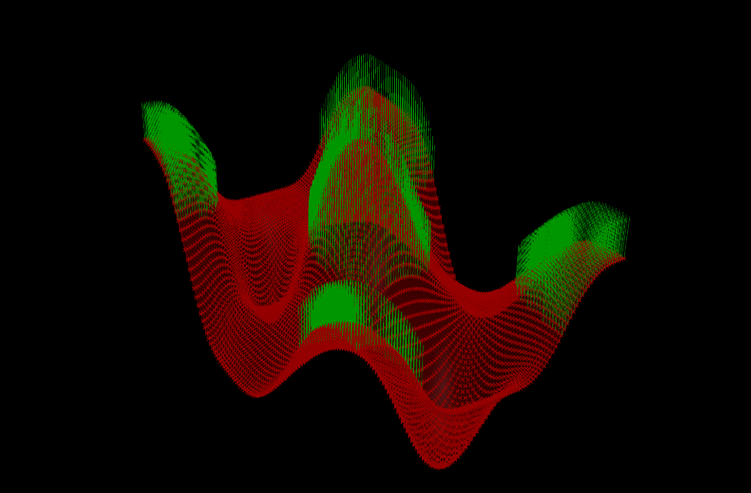 the values extracted from the high points and low points can be used as a diagrammatic zones of vegetal growth of species that grow in low-lying moist soils or drier upland conditions